Snapshot
- Snapshot
- Highlights
- Overview
- Exploration
Ownership
90% of Operating mine and surrounding claims
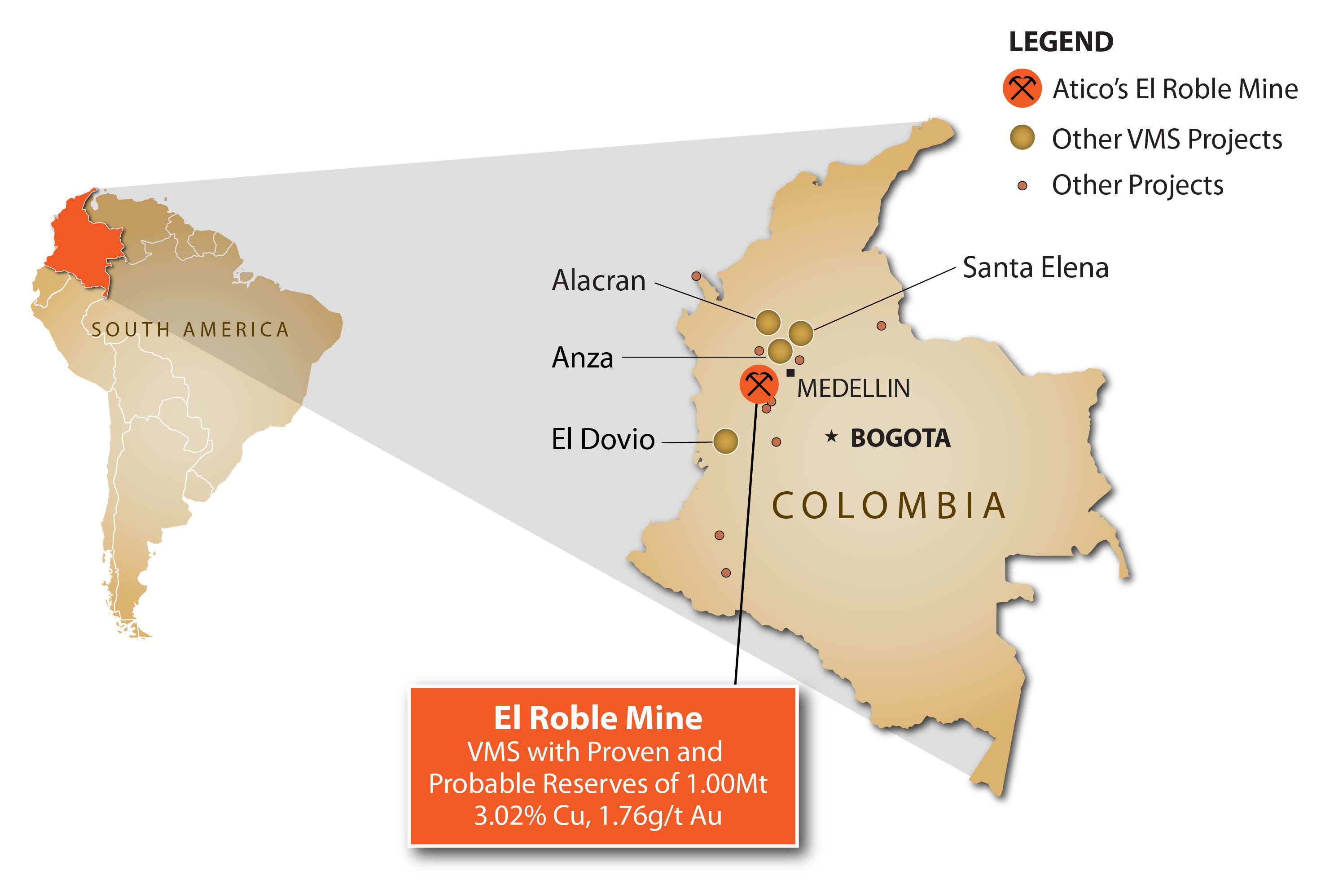
Location
Carmen de Atrato, Colombia (145km via paved highway from Medellin)
Infrastructure
Road accessible, Power grid, Abundant water and Mine/Plant facilities on site
Deposit type
Mafic-type Volcanic Massive Sulphide
Status
Producing mine with a 1,000 tonnes per day throughput capacity
End Product
Cu (+Au, Ag) Concentrate
Highlights
Atico has successfully completed scaling-up the El Roble mine from the original nominal capacity of 400 up to 1,000 tonnes per day. Key components of this achievement included the building of a new adit at the 1880 level, a new drystack tailings facility and upgrades to the processing facility.
Over the past 30+ years the mine has processed approximately 3.5 million tonnes of ore at an average grade of 2.67% copper and an estimated 2.63 g/t gold.
Atico's 2012-24 underground drilling at mine vicinity, has discovered additional high-grade mineralization below level 2000, the deposit remains open at depth and strike.
Proven and Probable reserves of 0.83 Mt at 2.49% Copper and 2.20g/t Gold.
Property-wide exploration has defined a productive contact and enclosing package of host rocks that extend 10 kilometers across property. The entire strike length is marked by volcanogenic massive sulfide mineralization indicators which have aided in identifying 21 prospective exploration targets for VMS mineralization within the 6,355 ha land package.
Overview
El Roble Cu-Au mine, the only copper mine in production in Colombia, started operations in 1990 and to-date has processed approximately 3.5 million tonnes of primarily pyrite-chalcopyrite ore with an average grade of 2.67% copper and an estimated gold grade of 2.63 g/t Au from a Cretaceous-age VMS deposit. The currently outlined dimensions of El Roble deposit measure 470 meters along strike by 550 meters in depth by up to 245 meters thick. The deposit is located at the contact between mafic volcanic flows of the Barroso Formation and overlying exhalites silicified felsic tuffs and pelagic sediments of the Penderisco Formation. Underground workings have been developed between levels 2223 and 1780. Recent exploration work below the 1886 level outlined the continuity of the VMS lens and showed that the deposit remains open at depth, south-east and north-east(strike).
VMS deposits, including mafic-type VMS deposits, typically occur in clusters (Galley et al., 2011). A cluster of mafic-type VMS deposits can, in aggregate, contain significant tonnage. The aggregate size depends on the number and characteristics of individual VMS deposits that make up the cluster. El Roble mine has a 6,355-hectare land package which encompasses a 1,000tpd process plant and a 10 kilometer underexplored favorable contact between basalt flows and pelagic sediments that control mineralization at the mine. The 2012-13 exploration program primarily focused at the mine vicinity and was successful in discovering additional VMS mineralization directly below level 2000, lowest production level at the time. While the 2014-24 exploration programs further added to this success by building upon previously discovered tonnage and upgrading the certainty of the resources. On the district scale, exploration has defined 15 geochemical targets on the 10 kilometer favorable contact that extends throughout the Company's concessions.
At the mine, drilling will focus on further defining the recently discovered resources and the extent of mineralization at depth and along strike. On the district scale, an aggressive drill program is planned to test the 21 geochemical targets with the goal of discovering additional VMS deposits.
2022-24 Exploration Program
Drilling - Mine Vicinity Program
The ongoing underground drilling program is aimed at further defining the discovered massive sulphide bodies below and above the 1,886m level, the current production level at the mine, to increase the current resources and test for occurrences of additional massive sulfide bodies at depth and along strike.
District Exploration Program
The district-wide program will target prospective targets along the 10 kilometer favorable contact with the goal of finding additional VMS deposits.
Geological mapping
The mapping program will continue surface (1:5,000 and 1:10,000 scale) and underground (1:250 scale), geological mapping of the El Roble mine, the immediate mine area and the 10-km favorable contact.
Soil and Rock chip sampling
Complete the geochemical sampling of the 21 drill targets and continue sampling on the 10-km favorable contact.
Geophysical survey - Gravity
Reinterpretation of the gravity survey on previously defined EM anomalies to discriminate massive sulfide bodies and provide more precise drill targets.